
Category:Maps of Luxembourg in the 8th century
English: 
Luxemburg (Luxembourg)

Maps of the history of Luxembourg: (BCE) (CE) 7th century · 8th century · 9th century · 10th century · 11th century · 12th century · 13th century · 14th century · 15th century · 16th century · 17th century · 18th century · 19th century · 20th century · 21st century ·
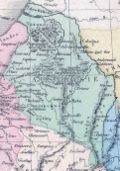
Media in category "Maps of Luxembourg in the 8th century"
The following 4 files are in this category, out of 4 total.
-
 Austrasie752.jpg 484 × 689; 78 KB
-
 C. 752 German Provinces.jpg 922 × 1,095; 767 KB
-
.jpg/120px-144_of_%27Histoire_de_la_Belgique_..._Troisième_edition%2C_entièrement_refondue_et_..._augmentée%2C_etc%27_(11042533084).jpg)
-
 Austrasie - btv1b8495009t.jpg 6,448 × 8,122; 7.29 MB


.jpg)
